

Planning guide · updated October 2026
Building a home in Montecito starts with the land under it. Before the design goes to the Montecito Board of Architectural Review, a lot has to answer a set of practical questions: which part of the Community Plan it sits in, whether a creek, flood zone or debris-flow area crosses it, how steep and stable it is, where the water and sewer come from, and how fire engines reach it. This guide walks through those questions with links to the County and district documents behind them. For the design review process itself, see our Montecito Board of Architectural Review guide.
Harrod Built builds custom homes, remodels, additions and ADUs on the Central Coast, including in Montecito, Summerland and across Santa Barbara County. To talk through a lot, a teardown or a set of plans, call 805-712-8993 or send the form at the end of this page.
The short answer
Building a home in Montecito means working within the County’s Montecito Community Plan and land use code, not City of Santa Barbara rules. The land sets the limits first: creek buffers, FEMA flood maps and the Montecito Fire Storm Impact Consideration Map for debris flows, slopes and grading limits, protected trees and habitat, Montecito Water District service or a private well, Montecito Sanitary District sewer or septic, and Montecito Fire access and water supply. Check those before buying or designing, then take the house through MBAR and County permits. Call 805-712-8993.
1. Where the rules come from
Montecito is County land with its own Community Plan
Montecito is an unincorporated community, so homes are permitted by Santa Barbara County, not by the City of Santa Barbara next door. The County’s Montecito Community Plan, adopted in 1992, sets the land use pattern and the policies for the whole planning area, from the ocean up into the mountains. Inland lots are zoned under the Montecito Land Use and Development Code; lots in the coastal zone follow the County’s coastal zoning ordinance, with a coastal development permit. The Montecito Architectural Guidelines and Development Standards add the design side, and our Montecito Board of Architectural Review guide covers how the board applies them.
| Part of Montecito | What the land is like | What tends to shape a home there |
|---|---|---|
| Central Urban sub-area (between the foothills and Highway 101) | Most of the established neighborhoods, mostly Semi-rural Residential designations, served by the Montecito Water District and, in most places, the Montecito Sanitary District. | Creeks running through lots, flood and debris-flow mapping near the main creeks, mature trees, neighbors close by, and design review on almost every exterior change. |
| Coastal sub-area (south of Highway 101) | Neighborhoods toward the beach, also mostly Semi-rural Residential, inside the coastal zone. | A coastal development permit under the County’s coastal zoning, lower-lying land near creek mouths, and the same flood mapping questions. |
| Mountain sub-area (the foothills and mountains) | Large Mountainous Area parcels kept for watershed, scenic and open land, with limited road access and services. | Steep slopes, grading limits, fire access and water supply, septic instead of sewer, and visibility from below. |
Summarized from the Montecito Community Plan (County of Santa Barbara; adopted 1992, text updated through 1995) and the County’s Montecito land use, zoning and habitat overlay maps on its Community Plan page. Your parcel’s designation and zone come from the County maps, not from the street name.
The Plan’s main land use change was the Semi-rural Residential designation, meant to keep low-density neighborhoods with a semi-rural character. It also moved the urban and rural boundary so that land along Mountain Drive and other mountainous areas became Mountainous Area, which the Plan describes as land kept free of intensive development for watershed, scenic enjoyment, grazing and orchards.
Two other points for buyers. Many older Montecito references mention the Montecito Growth Management Ordinance, which paced new homes for years. Per the County’s November 2025 staff report to the Montecito Planning Commission, it has not been implemented or enforced since state housing law (SB 330) took effect, and the County proposed repealing it. And if an address says “Santa Barbara” but the lot is inside City limits, the City’s process applies instead; see our Single Family Design Board guide.
2. Flood and debris-flow areas
Creeks, flood maps and the Storm Impact Consideration Map
Montecito’s main creeks run from the mountains to the ocean through the middle of the community: Montecito, Oak, San Ysidro and Romero creeks and their tributaries. After the January 2018 debris flow, flood and debris risk became one of the first things to check on any lot near them.
Three maps to look at
- FEMA flood maps. The County announced in August 2025 that the Board of Supervisors added FEMA’s Preliminary Flood Insurance Rate Maps to the County’s official flood hazard maps and stopped using the interim High Hazard Area maps used after 2018. You can look up a parcel on the FEMA Map Service Center.
- The Storm Impact Consideration Map. Montecito Fire describes this interactive Storm Impact Consideration Map as developed after the 2018 debris flow and last updated in December 2021. It shows the areas at greatest risk of damage in a debris flow, and owners in the red shading are asked to have a plan to evacuate in a severe storm. It is a preparedness map, not a zoning map, but it tells you a lot about a lot.
- The County’s Community Plan page maps, including the habitat overlay, which shows creek corridors and other mapped resources.
What Flood Control reviews
The County Flood Control District’s Development Review and Floodplain Management section checks proposed development for the floodplain management ordinance, setbacks from major watercourses, drainage plans and protection of existing development. The rules behind it are Chapter 15A (floodplain management) and Chapter 15B (development along watercourses). Per the August 2025 announcement, a lot that was only in the old interim High Hazard Area may no longer need Flood Control review, but projects next to streams, inside building setback areas, inside the FEMA preliminary or effective flood maps, or in the Repetitive Loss Zone may still need it.
The District’s Standard Conditions for Project Plan Approval show what that review can mean on a site: a site plan with the flood hazard boundary and a setback line from mapped waterways, a drainage report, new runoff directed to an acceptable watercourse, and, in a special flood hazard area, a lowest finished floor at least two feet above the 100-year water surface, flood-resistant materials up to that level, and an elevation certificate approved before occupancy. Those items shape the foundation, the floor height, the driveway and the landscape grading, so we price them in from the start (we confirm per lot).
What the County is building
The County’s Montecito Flood Control Master Plan looks at long-term flood fixes for the Montecito, Oak, San Ysidro and Romero creek drainages; the first phase was completed in late 2024. The County’s 2026 hazard mitigation progress report lists debris basin work in Montecito, some completed and some still planned. Montecito Fire’s winter storm preparedness page covers sandbags, alerts and the September 2026 community meeting on creeks and winter storms. Flood insurance is separate from homeowners insurance, and the County notes most new flood policies have a 30-day waiting period.
3. Creeks, habitat and trees
Buffers and protected trees decide where the house can go
Creek buffers
The Community Plan sets a presumptive minimum buffer from the top of a creek bank: 100 feet in rural areas and 50 feet in urban areas. The County can adjust it up or down case by case after looking at soils and bank stability, how water filters into the ground, slopes on each side, the 100-year floodplain and habitat. The buffer goes on the grading plans, and ground disturbance and vegetation removal are not allowed inside it. Riparian vegetation is protected as part of the buffer, and the Plan encourages restoring it where it was removed.
Habitat
The County maps environmentally sensitive habitat in Montecito on its habitat overlay. Oak woodlands are protected as habitat, not just as single trees; larger areas of coastal sage scrub are preserved where feasible; and trees that serve as raptor nesting or key roosting sites get a buffer set case by case. A biologist is often part of the team on lots with creeks or mapped habitat.
Trees
The Plan asks that specimen trees be preserved and that native trees of biological value be kept to the maximum extent feasible, with a Tree Protection Plan where new work may affect them. The Montecito Architectural Guidelines and Development Standards define a “significant tree” as a healthy tree more than 12 inches in diameter, or an oak more than 6 inches, measured 4 feet 6 inches above the root crown, and ask site plans to keep as many as possible. In practice the trees, the creek and the slope often decide the building footprint before the architect draws the house.
4. Slopes, grading and geology
Fit the house to the ground
The Community Plan and the Architectural Guidelines both push for homes that follow the land rather than reshape it:
- Minimize grading. Grading is kept to what the site needs, to avoid visible scars, slippage and erosion. Grading just to create or improve a view is not permitted.
- Height on fill. Where site work creates fill 10 feet or more in height, new structures are limited to an average height of 16 feet above finished grade.
- Grading waits for design approval. The Plan says land use permits for grading roads and building pads are not issued until the structure has Final BAR approval.
- Drainage and revegetation. Steeper lots need a drainage plan, previously scarred slopes need a revegetation plan, and natural drainage courses should stay close to their natural location.
- Faults. Construction within 50 feet of active fault traces is to be avoided, with special engineering where it can’t be.
- Radon. The County considers radon exposure in review where a site sits over a formation known as a radon source, such as the Rincon Formation.
A soils and geology report comes early on most foothill lots, and it often drives the foundation, retaining walls and driveway. Our hillside lot guide covers the construction side of sloped sites.
5. Water
Montecito Water District service, or a private well
District water
Most of Montecito is served by the Montecito Water District. Per its Application Process for Water Service, the District’s Board lifted its prohibition on new water meters in May 2019 (Ordinance 96). A Certificate of Water Service Availability (CWSA) is required for every change in land use that needs a County permit, and the District checks the estimated indoor and outdoor use against its water use limitation ordinance (Ordinance 89). That means the landscape plan and its water use calculations are part of the water application, not an afterthought. The meter application then adds fixture counts, irrigation calculations and fire flow calculations where sprinklers or hydrants are required. Our MBAR guide lists the full steps.
The Community Plan also notes that there is no lateral water main above Mountain Drive and calls for lower density in the foothills for that reason. On upper lots, water supply for firefighting can mean a tank, which the Plan asks to blend with the land, stay out of the viewshed and be screened by planting.
Private wells
The Montecito Water District is also the Montecito Groundwater Basin Groundwater Sustainability Agency, formed under the state’s groundwater law. Under its Ordinance 1 (April 2024), new wells inside the basin must be registered with the agency within 60 days of completion, and changes in ownership or status reported within 30 days; the forms are on its well registry page. A well still needs County permits, and its yield and water quality need testing before the design counts on it. Our well and septic guide covers the testing side (we confirm per lot).
6. Sewer or septic
Montecito Sanitary District, or an onsite system
The Community Plan notes that the Montecito Sanitary District serves most of the urban part of the planning area, while many homes in the foothills use septic systems. Which one a lot has changes the site plan and the schedule.
On sewer
The District reviews all development within its boundaries. Its Sewer Service Letter is needed for projects going through County Planning and again for County Building; it lists the conditions a project must meet. A project the District defines as a property improvement, including a teardown and rebuild, added bedrooms or bathrooms, or an increase in building area over 350 square feet, needs a District connection permit before the County issues the building permit, and the District inspects the work before final occupancy. Plans submitted to the District show fixture counts, the sewer lateral and main, any pump system, grading and landscape plans, and District easements. Owners converting an existing septic system start with the District’s septic to sewer conversion form.
On septic
The Community Plan notes poor percolation in parts of the foothills, in the Coldwater Sandstone formation, and says a successful system there takes careful engineering and adequate setbacks from slopes, drainage courses and wells. The County’s stream corridor policies, as the Plan summarizes them, also prohibit installing septic systems within stream corridors. The County Environmental Health septic system application lists what a design submittal needs. Percolation testing comes before the house is placed, because the system and its reserve area need their own room on the lot (we confirm per lot).
7. Fire
High fire hazard, access and water supply
The Community Plan describes the part of Montecito above Highway 101 as a high fire hazard area, with the mountainous areas the most hazardous. The Montecito Fire Department is an independent fire district. Its fire hazard severity zone page explains the state’s hazard zones and the District’s own local maps, which add areas where dense neighborhoods and ember-driven spread raise the risk; check the lookup map there for your parcel’s zone.
The District’s Development Standards set the rules for driveways, turnarounds, gates, hydrants, fire flow, sprinklers, roofs and defensible space, and plans go in through its plan submittal page. On the land side, the questions are simple: can an engine get to the house, is there enough water at the right pressure, and is there room for defensible space without cutting the trees and habitat the County wants kept. On a narrow foothill lane those three can pull against each other, so we look at them together. Our MBAR guide lists the District’s numbers, and our guide to building in a fire hazard severity zone covers the building code side.
8. Roads, privacy and neighbors
The semi-rural character the Plan protects
Montecito’s narrow, planted lanes are part of what the Community Plan protects. The Plan asks that new homes be sited, graded and landscaped to limit how visible they are from public roads, that outdoor lighting be kept low for privacy, and that informal paths be favored over curbs and sidewalks. The County does not grant encroachment permits for walls, fences or planting in the road right of way that would block safe pedestrian access or sight distance. The Architectural Guidelines ask for few driveway cuts, driveway openings as narrow as fire code allows, and only as much visible paving as parking and turning need.
Those goals carry into MBAR review, where the board looks at size compared with similar lots nearby, views, privacy, landscaping and lighting. The Montecito Architectural Guidelines and Development Standards encourage owners to show plans to neighbors early. Our Montecito Board of Architectural Review guide explains the board’s process, plans and story poles.
9. Planning the schedule
A realistic order of steps
| Step | What happens | What usually sets the pace |
|---|---|---|
| Lot and records check | Land use designation and zone, coastal or inland, habitat overlay, FEMA flood maps, the Storm Impact Consideration Map, fire hazard zone, sewer or septic, water service, survey, title and the permit history of what is already built. | Whether a creek, flood zone or old unpermitted work changes the plan. |
| Site studies | Topographic survey, soils and geology, a biologist or arborist where creeks, habitat or large trees are near the work, and a drainage approach. | Consultant schedules and the rainy season for some field work. |
| Utility letters | Montecito Water District service availability (CWSA), Montecito Sanitary District Sewer Service Letter, or a septic design for County Environmental Health. | How complete the plans are when each district reviews them. |
| Early design and MBAR | Site plan and massing shaped by setbacks, buffers and slopes, then Board of Architectural Review hearings. | Number of design review rounds. |
| Planning permit | Land Use Permit or Coastal Development Permit, with Flood Control, Fire and other agency review where they apply. | Agency comments and any added studies. |
| Construction drawings and plan check | Structural, energy and fire sprinkler work, fire access and water supply plans, grading and drainage plans, and final design review. | Plan check corrections and resubmittals. |
| District permits and meter | Sewer connection permit or septic permit, water meter application and installation scheduling. | District reviews and installation dates. |
| Construction and final | Build, inspections, district finals, elevation certificate where required, and final occupancy. | Weather, inspections and any changes after approval. |
The order we plan a Montecito home in. A simple remodel may skip several steps; a hillside, creekside or flood-mapped lot can add more.
The lots that move most smoothly start with the maps and the utilities, not the floor plan. A creek buffer, a flood elevation, a septic reserve area or a fire turnaround is far easier to design around than to fit in later. For the overall timeline of a new home, see how long a custom home takes; for the County permit path in general, see our Santa Barbara County permits guide; and for a guest house, our Santa Barbara County ADU guide.
10. Before you buy or design
12 questions to answer about a Montecito lot
- Is the lot in unincorporated Montecito, or inside the City of Santa Barbara?
- Which sub-area, land use designation and zone apply, and is it in the coastal zone?
- Is any part of it in a FEMA flood zone, or in the red shading on the Storm Impact Consideration Map?
- Does a creek or drainage course cross or border it, and where is the top of bank?
- Is any mapped habitat, oak woodland or large native tree near the likely building area?
- How steep is it, and is there a soils or geology report?
- Is it served by the Montecito Water District, and is there an existing meter?
- Is there a well on the property, and is it registered?
- Is it on sewer, or on septic, and has the soil been tested?
- Which fire hazard zone is it in, and can an engine reach the house site?
- Does what is built today match the permits on file?
- How does the planned house compare in size with homes on similar lots nearby?
If you have an architect already, we work from their drawings. If not, Harrod Drafting & Design can draw the house and the permit set.
How we help
Building in Montecito with Harrod Built
- Early read on the land. Harrod Built is a family general contractor based in Paso Robles, CSLB #986950. We look at the lot, the maps and the utility path with you or your architect and give a written estimate. You can confirm our license on the state license lookup.
- Site work done right. Grading, drainage, retaining walls, flood elevations, fire access and utility connections are where hillside and creekside lots are won or lost, and we plan them with the engineers before design review.
- Design review support. We help with constructability and budget during MBAR review and keep the built house matched to what was approved.
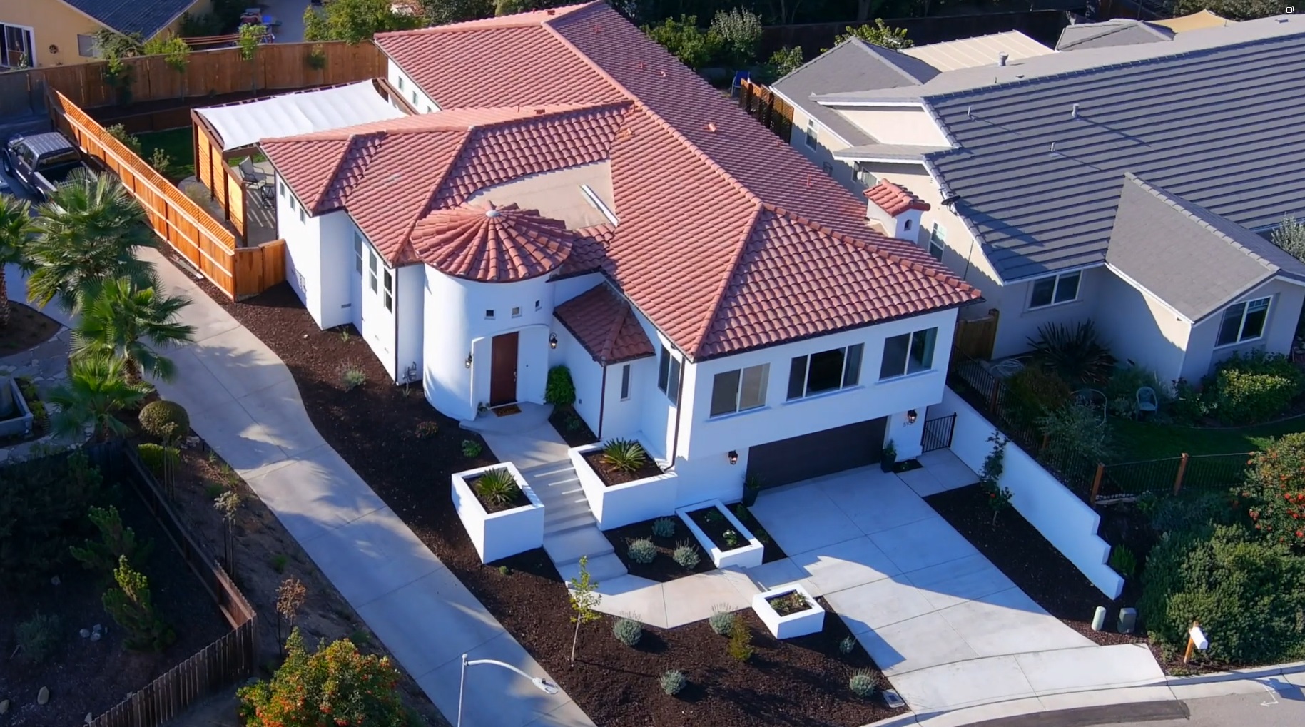
- Design support. Harrod Drafting & Design, our drafting studio, draws custom homes, home additions and permit sets, and we also build from plans by outside architects. Our Tuscan Revival home in Paso Robles and Spanish / Santa Barbara style home show the kind of tile-roof, garden-centered homes many Montecito owners want.
- Landscape. Paso Robles Landscaping, our landscape design and installation company, can plan native, fire-wise and water-efficient planting that fits creek buffers, tree protection and the water district’s limits.
See our Montecito custom home builder page and Santa Barbara County page, plus Summerland, Carpinteria and Hope Ranch. We build across San Luis Obispo, Monterey and Santa Barbara counties, with general contracting, design-build and remodels projects; our process page explains how a job runs. For energy rules on any new California home, see the Title 24 overview.
Looking at a lot, a teardown or a remodel in Montecito? We can walk the site with you or your architect, check the maps and the utility path, and give you a written estimate with the approvals mapped out. Call 805-712-8993 or contact us.
Sources: County of Santa Barbara Planning and Development: Montecito Community Plan and its land use, zoning and habitat overlay maps; Montecito Architectural Guidelines and Development Standards (limited update February 2025); Montecito Land Use and Development Code; Montecito Planning Commission staff report on the Montecito Growth Management Ordinance (November 2025). Santa Barbara County Flood Control and Water Conservation District: Development Review and Floodplain Management section, Standard Conditions for Project Plan Approval, August 2025 flood map press release, Montecito Flood Control Master Plan page; County hazard mitigation plan progress report (2026). Montecito Fire Department: fire hazard severity zone page, Development Standards, plan submittal page, winter storm preparedness page and Storm Impact Consideration Map. Montecito Water District: new meters page and Application Process for Water Service (July 2026). Montecito Groundwater Basin Groundwater Sustainability Agency: home page and well registry. Montecito Sanitary District: district permits and review, Sewer Service Letter and septic to sewer conversion pages. County Environmental Health septic system application. FEMA Map Service Center. All checked October 23, 2026. This guide is general information, not legal, engineering or code advice; the County of Santa Barbara and each district have the final word on what a lot and a project need.

Is Montecito part of the City of Santa Barbara?
No. Montecito is unincorporated Santa Barbara County. Homes there follow the County’s Montecito Community Plan, the Montecito Land Use and Development Code (or the coastal zoning ordinance near the coast) and review by the Montecito Board of Architectural Review, not the City’s boards.
How do I check debris-flow and flood risk on a Montecito lot?
Look up the parcel on the FEMA flood maps the County now uses, and on the Montecito Fire Department’s Storm Impact Consideration Map, which shows the areas at greatest risk of damage in a debris flow. Lots near creeks may also need County Flood Control review of setbacks, drainage and floor elevations.
How close to a creek can I build in Montecito?
The Montecito Community Plan sets a presumptive minimum buffer of 100 feet from top of bank in rural areas and 50 feet in urban areas. The County can adjust it case by case based on soils, slopes, the floodplain and habitat, and no ground disturbance is allowed inside the buffer.
Can I get a new water meter in Montecito?
Yes. The Montecito Water District lifted its prohibition on new meters in May 2019. A project needs a Certificate of Water Service Availability, with estimated water use checked against the District’s water use limitation ordinance, and then a meter application.
Do Montecito homes use sewer or septic?
Most of the urban part of Montecito is served by the Montecito Sanitary District, which issues a Sewer Service Letter and a connection permit for qualifying projects. Many foothill homes use septic systems, which need County Environmental Health approval and careful design on some soils.
Planning guides
Budget and planning guides
Montecito Board of Architectural Review
How the County’s Montecito board reviews new homes and remodels before permits.
Santa Barbara County building permits
City or County, design review, fire review and utilities: the permit path in Santa Barbara County.
Santa Barbara Single Family Design Board
When City of Santa Barbara homes need SFDB review, the stages, story poles, neighbors and Final Approval.
Building in Hope Ranch
Association architectural review on top of County permits.
ADU rules in Santa Barbara County
Guest houses and ADUs, two permit paths, and where state law wins.
Building in a fire hazard severity zone
Chapter 7A materials, vents, windows and defensible space, in plain language.
Building on a hillside lot
Soils reports, foundations, retaining walls, drainage and access on sloped lots.
Building with a well and septic
Well yield, water quality, septic design and permits on rural lots.
How long a custom home takes
Design, permits and construction, phase by phase.
Luxury custom homes in Santa Barbara
Large custom homes, whole-home remodels and additions in Santa Barbara, from design review through construction.
Building or remodeling in Carpinteria
City permits, the Architectural Review Board, story poles, coastal rules, fire, water and sewer.
Start your project
Building or remodeling in Montecito? Tell us about your project.
A few details help us call you back with useful answers about budget, schedule and permits.
805.712.8993michael@harrodbuilt.com
1345 Riverside Ave, Paso Robles, CA 93446
CSLB License #986950
