

Planning guide · updated October 2026
The Santa Ynez Valley is mostly open land: vineyards, pasture, oak savanna and small towns. Building a custom home here usually starts with a parcel, not a lot in a subdivision, and the parcel decides more than the floor plan does. Where the water comes from, where the septic fields go, which oaks and creeks need room, how a fire engine gets in, and whether the land is in an agricultural contract all shape where the house can sit. This guide walks through those questions for the unincorporated valley around Santa Ynez, Los Olivos and Ballard, with links to the official sources. For the permit path itself, see our Santa Barbara County permits guide. To talk about a specific parcel, call 805-712-8993.
Harrod Built builds custom homes, remodels and ADUs on the Central Coast, including new homes in the Santa Ynez Valley and across Santa Barbara County. To talk through a parcel or a set of plans, call 805-712-8993 or send the form at the end of this page.

The short answer
Building a custom home in the Santa Ynez Valley means working with the land first. The County’s Santa Ynez Valley Community Plan sorts the valley into townships, inner-rural ranchette land and rural agricultural land, and asks new homes to stay off ridgelines, keep clear of creeks and protect native oaks. Land under a Williamson Act contract limits the home site. Water comes from Improvement District No. 1 or a well, most rural homes use septic with extra disposal fields, and the County Fire Department sets driveway, turnaround and water rules. Call 805-712-8993.
1. Where you are building
Town lot, ranchette or ranch: the three kinds of valley land
The unincorporated valley around Santa Ynez, Los Olivos and Ballard is covered by the County’s Santa Ynez Valley Community Plan. The cities of Solvang and Buellton sit inside the valley but are outside the Plan; they have their own city rules, and our Solvang page covers how permits work there. The County’s community and area plans page describes the Plan area as the three townships plus the surrounding rural and agricultural land.
The Plan divides that land into categories, and knowing which one a parcel sits in is the first step:
| Land type in the Plan | What it is | What it usually means for a new home |
|---|---|---|
| Townships (urban) | The small town areas of Santa Ynez, Los Olivos and Ballard inside the urban boundary line. | Smaller lots, public water from Improvement District No. 1 in most cases, closer neighbors, and town character to fit. |
| Inner-Rural | The ring around the townships and cities, limited to agriculture, recreation and ranchette-style homes. Parcels generally run from five to forty acres. | The classic valley home site: a house, maybe a barn or guest house, and room for horses, a vineyard block or open pasture. Wells and septic are common. |
| Rural | Larger agricultural parcels, from forty acres to several hundred, with large-scale ranching and vineyards. | Long driveways, private water, septic, fire access and agricultural rules shape the site plan more than anything else. |
| Existing Developed Rural Neighborhoods | Older rural subdivisions the Plan maps separately and does not intend to expand. | Often lot-by-lot questions about water, septic and access on smaller rural lots. |
Summarized from the Santa Ynez Valley Community Plan (adopted October 6, 2009, amended February 11, 2025). Which category a parcel falls in, and its zoning, come from County records (we confirm per lot).
Most custom homes we’re asked about in the valley are on inner-rural or rural parcels, so the rest of this guide focuses on that kind of land. The Plan’s first stated concerns are keeping the valley’s rural character and scenic quality and protecting agriculture, and its policies follow from those two ideas.
2. Agricultural land
Building on agricultural land and Williamson Act parcels
Neighbors that farm
The Plan says land designated for agriculture in the valley is to be preserved for agricultural use, and new development must be compatible with farms next door. A new home next to agriculturally zoned land needs buffers, such as trees, shrubs, walls or fences, sized case by case. In practice that means thinking about where the house, outdoor living areas and bedrooms sit relative to a neighbor’s vineyard rows, spraying, dust and equipment.
Land in an agricultural preserve
Some valley parcels are enrolled in the County’s agricultural preserve program under the Williamson Act, which lowers property taxes in exchange for keeping the land in agriculture. The County’s Uniform Rules for Agricultural Preserves control what can be built on contracted land, and the current Uniform Rules (republished September 2026) say plainly that they can be more restrictive than the zoning:
- One principal home. A single principal dwelling is allowed on the premises, with limited exceptions for very large holdings.
- A defined home site. On parcels from twenty acres up to one hundred, the house, accessory structures including an ADU, landscaping and the non-farm driveway together must fit within two acres or a small share of the parcel, whichever is smaller. On smaller “superprime” contracts the envelope is 10,000 square feet, and on the larger of those parcels it can grow only by planting more land in commercial production.
- Farm buildings are separate. Barns, corrals and permitted farm employee housing generally don’t count against the home site, except on superprime contracts.
- Committee review. Every residential structure on contracted land, including additions and ADUs, goes to the Agricultural Preserve Advisory Committee for a compatibility review. The committee advises; the permit decision is made in the regular County process.
- Taxes on the home site. The home, its site and residential improvements such as the driveway, landscaping and domestic well are assessed at market value, not the reduced agricultural value.
The Rules also note that an owner can get an early read by bringing a proposal to the committee before applying. If you are buying contracted land, we look at the contract and the envelope before anyone draws a house (we confirm per lot). Guest houses on agricultural land are covered in our Santa Barbara County ADU guide.
3. Design and views
Ridgelines, views, colors and the design overlay
Fitting the land
The Plan’s visual policies ask new homes to stay quiet in the landscape. Its development standards say:
- Grading and buildings should avoid scarring the landscape and keep the bulk seen from public viewing areas low. The County can ask for larger setbacks, a smaller or lower house, less grading, more landscaping or a different driveway alignment.
- Houses, roads and driveways should be subordinate to prominent slopes, hilltops, ridgelines, mature trees and woodlands, and natural drainages.
- Building on a ridgeline isn’t allowed when another suitable spot exists on the property. Where there is no alternative, the house can’t break the skyline or stand out from public places, and a landscape plan or height limit may be added.
- Homes should be sited to limit how much native vegetation has to be cleared for fire buffers, and driveways can double as fuel management zones.
On projects that need a discretionary permit, the Plan adds darker, earth-tone roofs, natural-looking materials and non-reflective paint, including on fences, and textured, earth-colored masonry walls softened with vines or native planting. Highway 154 through the valley is a designated State Scenic Highway, and the Plan supports protecting its scenic qualities.
When the design board reviews a house
Parts of the valley carry the County’s Design Control (“D”) overlay. There, every structure needs design review by the Central Board of Architectural Review, with a short list of exceptions written into the County code for the valley:
- Agricultural accessory buildings under 1,000 square feet.
- Deer and livestock fencing up to eight feet tall.
- Structures that can’t be seen from public roads or other public areas. Landscape screening doesn’t count when deciding whether something is visible, so a hedge won’t take a house out of review.
- Other structures exempt under the County’s general design review rules.
Our Santa Barbara County permits guide explains where design review sits in the overall permit sequence. In Solvang, design review is run by the City’s Design Review Committee instead.
Dark skies
The Plan treats the valley’s night sky as a resource. All new development in the Plan area is subject to the County’s outdoor lighting regulations, and near creeks only fully shielded fixtures aimed away from the channel are allowed. We plan exterior lighting with the electrical design rather than leaving it to the end.
4. Oaks, creeks and wildlife
Protected trees, creek setbacks and sensitive habitat
Oaks and other protected trees
Valley oaks and coast live oaks are part of what people love about valley land, and the Plan protects them. It defines a native protected tree as one at least six inches in diameter at breast height (four and a half feet above the ground), and a non-native specimen tree as one at least 25 inches across. Grading, paving and other disturbance should generally stay out of the critical root zone, a circle around the trunk with a radius of one foot for every inch of trunk diameter, or the dripline where that applies.
- Homes are to be sized and sited to avoid damaging native protected trees such as oaks, sycamores, cottonwoods and willows, using buffers or clustering.
- Mature trees get priority over younger ones.
- Where protected trees are removed, they must be replaced under County standards, with a mitigation plan showing planting sites, locally collected stock where possible, and monitoring.
- On inner-rural and rural land, oak protection also follows the County’s Deciduous Oak Tree Protection and Regeneration Ordinance.
- Trees used by nesting or roosting raptors are to be preserved, with a buffer set case by case.
We locate the house, driveway, septic fields and trenches around the trees worth keeping, because root zones are easier to protect on paper than during excavation.
Creeks and the river
Many valley parcels have a creek, a seasonal drainage or riparian trees. The Plan sets minimum setbacks from the edge of riparian vegetation or the top of bank, whichever protects more: 50 feet in the urban and inner-rural areas, 100 feet in the rural area, and 200 feet from the Santa Ynez River. The County can adjust them up or down for slopes, habitat and erosion. Structures generally can’t go inside a natural stream corridor, though fences, pipelines, bridges and farm crossings can be allowed when there’s no other route.
The Plan also protects native grassland, coastal scrub, chaparral and wetlands, and asks for native, non-invasive landscaping. A biologist’s visit early on tells you whether any of that is on your parcel.
5. Floodplains, soils and history
Floodplains, geology, soils and archaeology
Floodplains
The Plan doesn’t allow development in the floodplains of the Santa Ynez River, Alamo Pintado Creek or Zanja de Cota Creek unless it is needed for reasonable use of the property while protecting riparian vegetation as far as feasible. Development in floodplain areas or with drainage issues goes to the Flood Control District for review, and homes that need raised floors in flood-prone areas are to sit on raised foundations rather than fill where feasible. Parcels in a dam inundation area carry a disclosure when sold.
Geology and soils
- A site-specific geologic or geotechnical investigation is required on sites on or near faults or landslides and on steeper ground, and the Plan singles out the potentially unstable Rincon Formation. Its recommendations go into the design.
- Structures can’t be built within 50 feet of an active or potentially active fault.
- Driveways serving a home must meet slope-stability standards.
- Where soils may be expansive, samples are tested before the building permit and foundations are engineered for them.
- On steeper slopes the Plan asks you to build on the flattest part of the site and requires a grading and drainage plan and a landscape plan to revegetate graded ground.
Our expansive clay soils guide explains why expansive soils matter, and the hillside guide linked below covers slopes.
Archaeology and historic resources
The valley has a deep cultural history. The Plan requires a Phase 1 archaeological survey when a County or contract archaeologist identifies the need. If remains are found and can’t be avoided by redesign, a Phase 2 study comes before any permit, and its recommendations become permit conditions. We leave room in the schedule for that possibility on undisturbed land.
6. Water
Water: Improvement District No. 1 or a well
On district water
The Santa Ynez River Water Conservation District, Improvement District No. 1 is the only public water supplier in the Plan area and serves the communities of Santa Ynez, Los Olivos and Ballard. Several small water systems and many private water systems serve the rest of the valley. Its new service page says every new connection has special requirements, so the first step is a conversation with district staff. Its water service application asks for:
- A detailed plot or site plan and floor plan.
- Indoor and outdoor water demand calculations from a licensed engineer, architect or landscape architect.
- The County Fire Department’s conditions letter.
- The assessor’s parcel map and a copy of the land use permit or conditional use permit.
- A written description of every existing and proposed building.
The district then sends a written requirements letter with its terms and conditions. The application says that reviewing it doesn’t commit the district to serve the project, that a main extension may be required, and that the application expires after a year, if the building permit lapses, or if the project changes. Because the district wants the fire letter and the land use permit first, water often sets the pace of the whole approval.
County Environmental Health Services’ application completeness requirements accept an availability letter to start, but a “can and will serve” letter or connection permit is needed before zoning clearance.
On a well
Outside the district, homes rely on a small water system or a private well. A new well needs a County well permit first. For a home on its own well, Environmental Health Services asks for the well permit number, the well completion report, source yield testing and a water quality chemical analysis under County Code Chapter 34B.
Much of the valley also sits in the Eastern Management Area of the Santa Ynez River Valley Groundwater Basin. The Eastern Management Area Groundwater Sustainability Agency’s well permit verification page and posted flowchart describe the process: the well application goes to Environmental Health Services, which sends it to the agency; the agency’s consultant reviews whether it is a new well, a replacement well or a river alluvium well; new wells go to the agency’s committee for a written verification decision; and only then does the County decide on the well permit. Under the agency’s well registration ordinance, a new well must be registered within 60 days of completion. We ask about the current process before drilling (we confirm per lot).
The Plan also asks every new home to use water-efficient design, fixtures and landscaping, which also helps the water demand calculations the district asks for.
7. Septic
Septic systems in the valley
Outside the townships’ sewer service, homes use an onsite wastewater (septic) system permitted by Environmental Health Services. The County’s septic permit application for new systems lists what the application needs: a percolation test report signed by a registered civil or soils engineer, a system design stamped by a qualified professional, a plot plan and floor plans, and the water district’s “can and will serve” letter or a water system permit application. Systems are either standard or supplemental (with added treatment).
The Community Plan adds valley-specific rules on top of the County’s:
- Two fields plus a reserve. Each septic system gets two disposal fields, so one can take over if the other fails, and a third expansion area is set aside where nothing can be built. A driveway can cross it only on a constrained site, on a pervious surface such as turf block.
- Gravity first. Gravity flow to the tank and field is preferred to limit pump failures; pumping is allowed on existing lots where gravity won’t work.
- Distance from creeks. Septic systems must be at least 100 feet from the top of bank of a creek or tributary.
- Nitrates. Shallow-rooted, non-invasive plants go over leach fields and paved driveways can’t. On parcels of five acres or less with limited separation to groundwater, systems using drywells need advanced treatment for nitrates.
Two disposal fields and an expansion area take real space, and with the well, its setbacks and the creek buffer, they often decide where the house can go. Our well and septic guide goes deeper on how wells and septic shape a rural site.
8. Fire
Fire access, stored water and defensible space
Check the map
CAL FIRE’s Office of the State Fire Marshal publishes the Fire Hazard Severity Zone maps, with Moderate, High and Very High zones; the state responsibility area maps took effect April 1, 2024, and local responsibility area maps were released to local jurisdictions in 2025. Much of the valley’s grassland, oak woodland and foothills is mapped. A mapped zone brings the wildfire construction rules in Chapter 7A of the building code; our guide to building in a fire hazard severity zone covers materials, vents, windows and decks.
The driveway
The Santa Barbara County Fire Department publishes its development standards, including a private road and driveway standard and a completeness guide for planning projects. For a typical valley home:
- A driveway can serve up to four homes or two parcels, with a 12-foot travel lane, 16 feet of clear width and 13 feet 6 inches of clear height, plus 10 feet of vegetation clearance on each side.
- Driveways longer than 150 feet need a turnout near the midpoint and a hard-surfaced, nearly level turnaround at the building site; longer driveways need more turnouts.
- Fire access has to reach within 150 feet of every part of the home’s first-floor exterior walls.
- Steep driveway grades need the department’s approval. Gates, bridges and cattle guards go on the plans, gates must be approved, and bridges and cattle guards need posted weight limits.
- Access easements across a neighbor’s land must be wide enough to build the required driveway.
The Plan adds that building sites should be on the part of the parcel with the lowest fire hazard and should limit long or steep driveways. Those two goals often point to the same spot.
Water for firefighting
Fire water comes from the water district (with a “can and will serve” letter for fire flow) or from a private system. On a well, that usually means a stored water tank, located and sized on the plans under the department’s stored water standard, using the California Fire Code or the national rural water supply standard, and reserved for fire protection only, above what the house uses.
Defensible space and vegetation plans
In state responsibility areas, very high hazard zones and the County’s designated high fire hazard area, the department’s defensible space standard applies, along with a fire protection plan. In the valley’s high fire hazard areas the Plan also lets the department require a fire and vegetation management plan before grading permits: a site plan with topography, the landscape plan, how dead vegetation, ladder fuels and trees will be managed, and a maintenance schedule, checked before occupancy and each year after. Exact conditions are set for each project in the fire department’s conditions letter (we confirm per lot).
9. The order of approvals
How a valley home gets approved and built
| Step | What happens | What usually sets the pace |
|---|---|---|
| Parcel check | Zoning, overlays, Plan land type, any Williamson Act contract, fire hazard zone, floodplain, creeks, oaks, water source and septic suitability. | Whether water and septic have a clear answer. |
| Site studies | Topographic survey, soils (geotechnical) report, percolation testing, and where needed an arborist, biologist or archaeologist. | Consultant schedules and, for wells, drilling and yield testing. |
| Site plan and design | House, barn, guest house, driveway, septic fields and expansion area, well, oaks and creek setbacks drawn together. | How many constraints overlap on the parcel. |
| Agricultural and design review | Agricultural Preserve Advisory Committee on contracted land; Central Board of Architectural Review where the Design Control overlay applies. | Board agendas and any redesign the board asks for. |
| Water, septic and fire | Requirements letter from the water district or well permits and testing; septic permit; fire department conditions. | Water paperwork, which often needs the fire letter and the land use permit first. |
| Land use and building permits | County land use permit, then building, grading and drainage plan review. | Rounds of plan check corrections. |
| Construction | Access road and turnaround first, then foundations, framing, utilities, finishes and landscape. | Weather, inspections and long utility runs. |
| Final | Fire department sign-off, septic and water final, building final, then move in. | Paperwork from each agency and consultant. |
The order we plan a new valley home in. Simple town lots skip several steps; large agricultural parcels can add more.
Because land use, water, septic and fire all affect where the house sits, the early studies matter more here than on a town lot. Our how long a custom home takes lays out the phases, and the Central Coast cost guide explains what moves a budget, including site work on rural land.
10. Checklist
Twelve questions to answer before you buy or design
- Is the parcel in a township, inner-rural, rural or existing rural neighborhood area, and what is its zoning?
- Is it under a Williamson Act contract, and how big is the allowed home site?
- Does the Design Control overlay apply, and can the house be seen from a public road?
- Is there a ridgeline, hilltop or prominent slope the house should stay below?
- Where are the protected oaks and their root zones?
- Is there a creek, drainage or riparian area, and what setback applies?
- Is any part of the parcel in a floodplain or near a fault?
- Is it served by Improvement District No. 1, a small water system or a well?
- If a well, what do the yield and water quality tests show, and has the groundwater agency verified it?
- Will the soils perc, with room for two disposal fields and an expansion area?
- Can a fire engine reach the house, turn around and find water?
- Is it in a mapped fire hazard severity zone?
If you have an architect already, we work from their drawings. If not, Harrod Drafting & Design can draw the house and the permit set. For land shopping in general, our buying land guide and rural acreage guide cover the same questions from San Luis Obispo County, and our Paso Robles wine country guide looks at vineyard land up the 101.
How we help
Building in the Santa Ynez Valley with Harrod Built
- Land first. Harrod Built is a family general contractor based in Paso Robles, CSLB #986950. We walk the parcel with you or your architect, look at water, septic, oaks, creeks, access and fire, and then give a written estimate. You can confirm our license on the state license lookup.
- The approvals mapped out. We line up the surveyor, soils engineer, septic designer, well driller and any arborist or biologist early, and sequence the water, fire and design paperwork so one doesn’t hold up another.
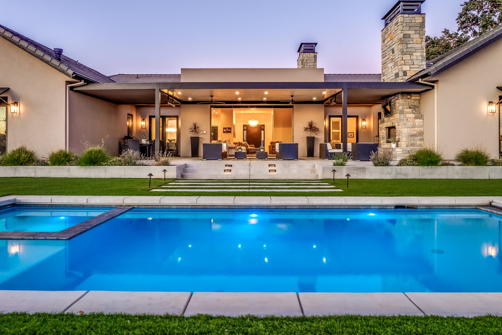
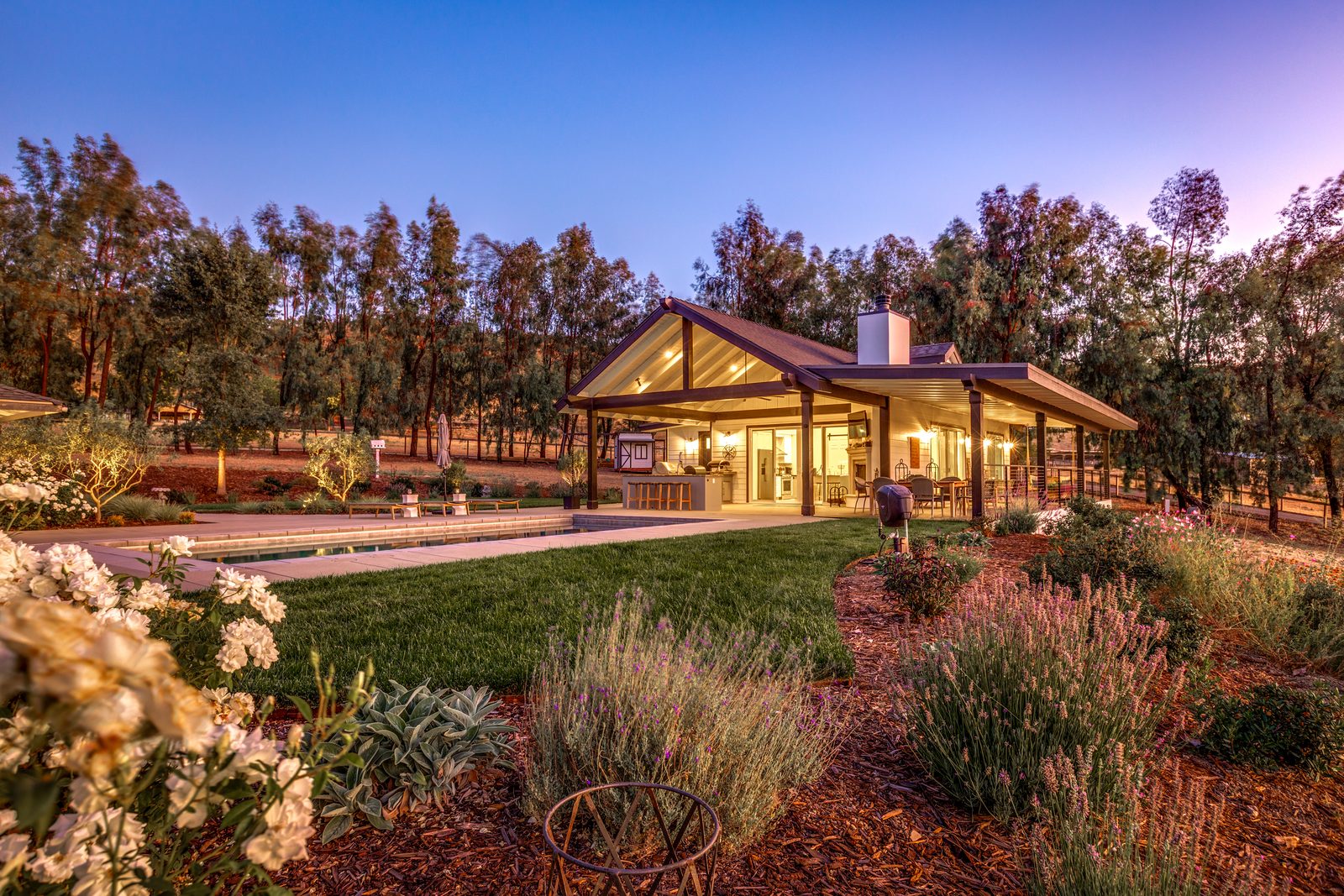
- The whole property. Many valley owners want a barn, guest house, pool or outdoor kitchen too. We plan them with the house, inside any agricultural home site limit. Our Modern Ranch in Templeton and Modern Ranch ADU in Paso Robles are examples of the single-story ranch homes and guest houses we build.
- Design support. Harrod Drafting & Design, our drafting studio, draws custom homes and permit sets, and we also build from plans by outside architects.
- Landscape. Paso Robles Landscaping, our landscape design and installation company, can plan native, fire-wise and water-efficient planting, shallow-rooted planting over leach fields, and oak-friendly grading.
See our Santa Ynez page and our Solvang, Los Olivos and Buellton pages, plus the Santa Barbara County hub. We build across San Luis Obispo, Monterey and Santa Barbara counties, with general contracting and design-build projects; our process page explains how a job runs. For energy rules on any new California home, see the Title 24 overview.
Looking at land or plans in the Santa Ynez Valley? We can walk the parcel with you or your architect, look at water, septic, oaks, access and fire, and give you a written estimate with the approvals mapped out. Call 805-712-8993 or contact us.
Sources: Santa Barbara County Planning & Development, Santa Ynez Valley Community Plan (adopted October 6, 2009, amended February 11, 2025), including its Design Control overlay provisions, and the County’s community and area plans and Central Board of Architectural Review pages; County Uniform Rules for Agricultural Preserves and Farmland Security Zones (published September 2026); County Environmental Health Services application completeness requirements and septic (OWTS) permit application for new systems; Santa Ynez River Water Conservation District, Improvement District No. 1, home page, new service page and water service application; Eastern Management Area Groundwater Sustainability Agency well permit verification page, process document, flowchart and well registration ordinance; Santa Barbara County Fire Department development standards, private road and driveway standard, stored water standard and completeness guide for planning projects; CAL FIRE Office of the State Fire Marshal Fire Hazard Severity Zones page. All checked October 21, 2026. This guide is general information, not legal or code advice; the County, the water district, the groundwater agency and the fire department have the final word on what a project needs.

What should I check before buying land to build in the Santa Ynez Valley?
Start with the parcel’s zoning and its land type in the Santa Ynez Valley Community Plan, any Williamson Act contract, the water source, whether the soils will support septic with two disposal fields and an expansion area, protected oaks, creek setbacks, floodplains, fire hazard zone and driveway access. Those decide where a house can go and how big the home site can be.
Can I build a house on Williamson Act land in the Santa Ynez Valley?
Usually one principal home is allowed, but the County’s Uniform Rules limit the home site. On parcels from twenty to one hundred acres, the house, accessory buildings, landscaping and non-farm driveway must fit within two acres or a small share of the parcel, whichever is smaller. The Agricultural Preserve Advisory Committee reviews every residential structure on contracted land.
Does my Santa Ynez Valley home need design review?
If the parcel carries the Design Control overlay, every structure needs review by the Central Board of Architectural Review unless it is exempt, such as farm buildings under 1,000 square feet, livestock fencing up to eight feet, or structures that can’t be seen from public roads or other public areas. Landscape screening doesn’t count toward that last exemption.
Where does water come from for a new home in Santa Ynez or Los Olivos?
In the townships and the rest of its service area, usually Improvement District No. 1, which issues a requirements letter after reviewing a water service application with the site plan, water demand calculations, the fire department’s conditions letter and the land use permit. Elsewhere, a private well, which needs a County well permit, yield and water quality testing, and in the Eastern Management Area a written verification from the groundwater agency.
What septic rules apply in the Santa Ynez Valley?
Beyond the County’s septic permit, the Community Plan requires two disposal fields plus a reserved expansion area, a setback of at least 100 feet from creek banks, gravity flow where feasible, shallow-rooted plants and no paved driveways over leach fields, and advanced nitrate treatment for drywell systems on smaller parcels with limited groundwater separation.
Planning guides
Budget and planning guides
Santa Barbara County building permits
City or County, design review, fire review and utilities: the permit path in Santa Barbara County.
ADU rules in Santa Barbara County
Guest houses and ADUs on unincorporated County lots, including water, septic and fire.
Building in a fire hazard severity zone
Chapter 7A materials, vents, windows and defensible space, in plain language.
Building a home in Paso Robles wine country
Vineyard land, wells, septic and rural permits up the 101 in San Luis Obispo County.
Building with a well and septic
How wells and septic systems shape where a rural house can go.
Building on rural acreage
Access, utilities, water and site work on larger rural parcels.
Expansive clay soils
Why some inland soils swell and shrink, and how foundations are designed for it.
Building on a hillside lot
Soils reports, foundations, retaining walls, drainage and access on sloped lots.
How long a custom home takes
Design, permits and construction, phase by phase.
Start your project
Building in the Santa Ynez Valley? Tell us about your land.
A few details help us call you back with useful answers about budget, schedule and permits.
805.712.8993michael@harrodbuilt.com
1345 Riverside Ave, Paso Robles, CA 93446
CSLB License #986950
