

Planning guide · updated October 2026
On the Big Sur coast, the first question for a new home is not what it will look like. It is whether anyone driving Highway 1 will be able to see it. Big Sur is unincorporated Monterey County, so a building permit runs through the County, but almost every project first needs a coastal permit under the Big Sur Coast Land Use Plan and its critical viewshed rule. Here is how the permit path works, step by step, and what to have ready.

The short answer
A Big Sur building permit starts with a coastal permit from Monterey County. The project is staked and flagged, and the County checks whether any part of it can be seen from Highway 1 or major public viewpoints. Visible new development is generally prohibited, so the house is sited and shaped to stay out of view. Water, septic, geology and fire access are proven before the building permit. We plan it from the first site walk: 805-712-8993.
1. Who reviews what
Who reviews a Big Sur project
Big Sur has no city government. Planning and building permits come from Monterey County Housing & Community Development (HCD), and the rules come from the County’s local coastal program for the Big Sur coast, which the California Coastal Commission certified. Several groups look at a typical new home:
- HCD Planning. Decides which coastal permit applies, reviews the staking, the viewshed and the reports, and writes the conditions.
- Big Sur Coast Land Use Advisory Committee (LUAC). A local advisory committee that usually visits the site and comments at a publicly noticed meeting before the County decides.
- Zoning Administrator or Planning Commission. Holds the public hearing and approves, conditions or denies the coastal permit.
- Board of Supervisors and the Coastal Commission. Hear appeals, and many Big Sur approvals can be appealed to the Coastal Commission.
- Environmental Health Bureau. Reviews the water source and the septic system.
- The fire agency. Reviews fire access, water for firefighting and defensible space. Which agency that is depends on the parcel (we confirm per lot).
- Caltrans. Issues an encroachment permit for any driveway work or other work inside the Highway 1 right of way.
- HCD Building. Plan check and inspections once the coastal permit is final.
2. The rulebook
The Big Sur Coast Land Use Plan and the Coastal Implementation Plan
The Big Sur Coast Land Use Plan was certified in 1986 and has been amended since (the County lists the version amended as of January 2016). It is the policy document. The Big Sur Coastal Implementation Plan (Part 3 of the County’s coastal plan, Chapter 20.145 of the County code) turns those policies into development regulations, and the County’s coastal zoning code, Title 20, sets the zoning districts, permit types and appeals.
Much of the private land along the coast is in rural residential or Watershed and Scenic Conservation zoning with a design control overlay (we confirm per lot). Under the County’s Watershed and Scenic Conservation zoning chapter, development inside the Big Sur critical viewshed always needs a coastal development permit, as does development on slopes of 30 percent or more, ridgeline development, development within 100 feet of mapped or field-identified sensitive habitat, and development with positive archaeological reports.
An update is underway. The County has been working on an update to the Big Sur Coast Land Use Plan through Planning Commission workshops and community meetings. Until the County adopts it and the Coastal Commission certifies it, the existing plan governs. We check the status for every project.
3. The critical viewshed
What the critical viewshed rule says
The plan’s key scenic policy is plain: the County’s policy is to prohibit all future public or private development visible from Highway 1 and major public viewing areas, and to put siting and design controls on development that is not visible. It applies to buildings, roads, utilities, lighting, grading and the removal of natural materials.
Where it is measured from. The critical viewshed is everything within sight of Highway 1 and major public viewing areas, including turnouts and beaches, plus named places such as Soberanes Point, Garrapata Beach, Bixby Creek Turnout, Hurricane Point Overlook, upper Sycamore Canyon Road, Pfeiffer Beach and specific views from the Old Coast Road. Areas visible only from the hiking trails on the plan’s trails map are not part of it.
How strict the test is. The standard is whether any portion of the proposed development is visible, with normal, unaided vision, in any direction, for any amount of time, in any season. Ocean views from Highway 1 cannot be blocked with artificial berms or landscaping. Distant development that is technically in the line of sight is not counted as visible if it is sited and designed so it cannot be seen. Exterior lights that would be directly visible from those viewpoints are prohibited.
| Inside the critical viewshed | Outside the critical viewshed | |
|---|---|---|
| The test | Can any part of the project be seen from Highway 1 or a major public viewing area? | Not visible from those places, but still reviewed for how it sits on the land |
| Basic rule | New visible development is prohibited, apart from narrow exceptions written into the plan | Allowed with siting and design controls |
| What the County asks for | Resite, lower or reshape the house until it cannot be seen; if that is impossible, the site is treated as unsuitable | The least visible part of the parcel, natural screening, no open hillsides or skylines, minimal grading and tree removal |
| Materials and color | Not a substitute for being out of sight; landscaping and berms cannot be used to hide a visible house | Subordinate materials and colors that blend with the setting; native screening where it can extend existing cover |
| Roads and grading | Not allowed to damage or intrude on the viewshed, and no work starts until permits and appeals are done | Avoid visible roads and steep slopes; use existing roads where feasible |
What happens if it shows. If another building site on the parcel would comply, the County requires the move. Changes to design, height or bulk are required where they make the project approvable. If a project cannot be resited or redesigned to comply, the plan treats the site as unsuitable for development. The same applies to new roads and grading: they cannot damage or intrude on the viewshed, and that work cannot start until the whole project has finished the permit and appeal process.
The narrow exceptions. The plan allows careful development in the rural community centers (Big Sur Valley, Lucia, Gorda and Pacific Valley, plus a few named visitor sites), essential ranching structures that cannot go elsewhere, certain highway and public facilities, and existing vacant residential lots in two mapped areas near Rocky Point and Otter Cove under extra standards: narrow driveways, blending roofs and colors, no floodlighting, and a scenic easement over the undeveloped part of the lot. Whether a lot falls in an exception is a mapping question (we confirm per lot).
4. Staking and flagging
How the County decides what can be seen
Every development application in Big Sur needs an individual on-site investigation. Under the plan:
- Poles for the house. The proposed buildings are shown at their real dimensions, height and rooflines with poles.
- Stakes for the road. Access roads and driveways are marked with stakes and flags.
- Left up for the whole review. The staking stays in place for the duration of the review and approval process, which runs through the hearing.
- Photographed. The staking is recorded in photographs with the proposed project superimposed.
- Built as shown. New development that does not match the approved representations has to be removed.
The County’s staking guidelines are outside the plan itself. The Coastal Commission’s periodic review of the Monterey County coastal program describes them as brightly colored flags on 2×4 poles, plus a continuous band of bright, wide plastic fencing outlining the full building perimeter and height in visually sensitive areas such as the Big Sur critical viewshed (we confirm per lot). In a County staff report on a Big Sur rebuild, the LUAC noted that heights written on corner stakes, with no flagging between the corners, did not show the bulk of the house, and staff asked that future staking be complete enough to convey bulk, mass and height to a casual observer.
Two practical points: we look from Highway 1 ourselves, in both directions and from the turnouts, before the poles go up, and we stake the driveway, retaining walls, water tanks and solar arrays as well as the house, because they count too.
5. Outside the viewshed
Siting and design rules when the house cannot be seen from the highway
Being out of the critical viewshed does not mean anything goes. The plan’s rules for land outside it:
- Least visible site. The part of the parcel least visible from public viewpoints is considered the right place for new structures, and the views and privacy of neighbors are considered too.
- Natural screening. Build where existing topography or trees screen the house, not on open hillsides or silhouetted ridges, and without excavation scars.
- Minimal landform change. Structures and roads are designed to minimize grading and to avoid, where feasible, removing healthy trees.
- Subordinate design. New development should be subordinate to and blend with its setting, and the County can require changes to siting, size, shape, color, texture, materials, access and screening.
- Native screening. Landscape screening is allowed where it is a moderate extension of native forest or chaparral, using similar species.
- Roads. Sites are chosen to avoid visible access roads. A new road is considered only where using an existing road is not feasible or permission to use one has been refused in writing, and it must avoid steep slopes, follow contours and carry fire equipment.
- Utilities and lighting. Utilities go underground unless there is an overriding constraint. Exterior lighting is shielded, downlit and minimal so the light source is not visible.
6. Which permit
Coastal permits, the hearing and the building permit
Under the County’s coastal development permit chapter, all development in the coastal zone needs a coastal development permit unless it is exempt, and some principal uses, such as the first single-family home on a lot in Watershed and Scenic Conservation zoning, are processed as a Coastal Administrative Permit instead. In Big Sur, the parcel usually decides it: viewshed, slope, habitat, bluff and archaeology triggers each call for a full coastal development permit, and every coastal development permit needs a public hearing.
When a project needs several approvals, the County bundles them into a Combined Development Permit. A Planning Commission staff report for a rebuild in the Big Sur Coast plan area shows a typical package: a Coastal Administrative Permit and Design Approval for the house, separate coastal development permits for building within 50 feet of a coastal bluff and on slopes over 30 percent, and a permit for work within 750 feet of known archaeological resources, each with its own conditions.
Not as exempt as you might think. The code exempts many improvements to existing homes, but not in an area designated as highly scenic in a certified land use plan, in sensitive habitat or within 50 feet of a bluff edge. Building or expanding a well or septic system also needs a permit. On property between the sea and the first public road, or in significant scenic areas, an addition of 10 percent or more of the floor area, a new story or loft, or a large detached garage needs a permit as well (we confirm per lot).
Reports. Expect some combination of a survey and topography, geology and soils reports, a biological survey, an archaeological report, a tree assessment, a septic feasibility report, proof of water and a fire access assessment. The County keeps a list of background reports required in the Big Sur area (we confirm per lot). Applications go in online through Accela Citizen Access, and the County moved to its ePermitHub digital plan room in September 2026.
7. Appeals
Who can appeal, and where
Under the County’s appeals chapter:
- To the Board of Supervisors. Generally, any aggrieved person who took part in the hearing can appeal within 10 days after written notice of the decision is mailed to the applicant. The Board hears the matter fresh (de novo) and generally decides within 60 days.
- To the Coastal Commission. Approvals between the sea and the first through public road, within 300 feet of a beach, within 100 feet of a wetland or stream, or within 300 feet of the top of a coastal bluff can be appealed to the Coastal Commission, and so can any approval of a conditional use. In Big Sur, the Coastal Commission’s own review notes that County permits seaward of Highway 1 are appealable, while most permits for homes inland of the highway are not, unless they fall in another category (we confirm per lot).
- Effect. An appeal stays the decision until it is resolved, which is one more reason the staking stays up and road work waits.
The Coastal Commission side works the same way across the state; our coastal development permit guide for SLO County explains it in more detail.
8. Water and septic
Proving water and septic on a Big Sur parcel
Most Big Sur parcels have no public water or sewer, and the plan treats water as the base for every other resource.
- Proof of water. A new home must show, by seasonal testing, an adequate supply of good quality from a well, a spring or stream source, or a permitted community system. The plan gives at least half a gallon per minute per single-family home, through the dry season, as an example of adequate.
- Wells before surface water. Where groundwater is available on the site, new diversions from perennial streams and the springs that feed them are avoided, and a well that taps stream subflow is treated as a diversion.
- Water rights. Water from a source off the parcel needs the necessary state water rights before County approval, and new or expanded systems cannot move water out of the watershed of a perennial stream.
- Shared systems. Small water systems serving more than one user go through Environmental Health under state and County rules.
Septic. Septic systems follow the County Environmental Health Bureau’s Local Agency Management Program, approved in May 2018 and written into County Code Chapter 15.20. A qualified professional prepares a feasibility report with at least one deep groundwater boring, a soil profile and percolation tests for the primary dispersal field and the expansion area. A qualified designer then shows room for primary and secondary dispersal and, where required, a 100 percent expansion area, and Environmental Health visits the site after it accepts the report. Steep or shallow soils often lead to an alternative treatment system, which needs an operating permit. Wet-weather groundwater testing can set the calendar (we confirm per lot).
Our well and septic guide for North County covers how wells and septic shape a rural lot; in Big Sur, slope, setbacks from streams and the viewshed tighten every choice.
9. Hazards and fire
Geology, bluffs and fire access
Geology. The plan requires soils and geologic reports for structures and roads in areas of known or suspected hazards, including landslide areas, fault zones and floodplains. Structures are kept at least 50 feet from an active or potentially active fault. Any development within 50 feet of a cliff or bluff face, or within a 20-degree angle from the toe of a cliff, needs a geologic report showing the area is stable. New building in mapped floodplains is prohibited apart from narrow uses. Where hazards are significant, permits often require a recorded deed restriction describing the hazard, and bluff-top setbacks are set so the house will not need a seawall.
Fire. Much of the coast is mapped in high or very high fire hazard severity zones; check the CAL FIRE Fire Hazard Severity Zone maps for the parcel (we confirm per lot). The plan asks that each development proposal come with a written assessment of access, reviewed by fire officials, and that roads serving new homes let fire engines in while residents get out. In State Responsibility Areas and very high hazard zones, the Board of Forestry’s State Minimum Fire Safe Regulations apply to new construction (we confirm per lot):
- Driveways. At least one 10-foot traffic lane, 14 feet of clear width and 13 feet 6 inches of clear height.
- Turnouts and turnarounds. A turnout near the midpoint of a driveway over 150 feet long, turnouts no more than 400 feet apart beyond 800 feet, and a turnaround within 50 feet of the building on a driveway over 300 feet.
- Gates. At least 2 feet wider than the lane, 14 feet minimum, and set back at least 30 feet from the road.
Water storage for firefighting is set by the fire agency under the fire code (we confirm per lot). The plan itself calls for 12-foot roads to serve new homes unless frequent turnouts satisfy the fire agencies. New homes also need fire sprinklers, wildfire-resistant construction and defensible space under the state’s defensible space law. Our guide to building in a fire hazard severity zone covers the construction side, and our hillside lot guide covers foundations, retaining walls and drainage on steep ground.
10. Trees, habitat and history
Trees, sensitive habitat and archaeology
- Trees. All tree removal has to fit the plan’s resource protection policies, and landmark trees (visually or historically significant, exemplary of the species, or very old) are protected permanently. Removing non-native trees is encouraged.
- Sensitive habitat. Development within 100 feet of mapped or field-identified sensitive habitat needs a coastal development permit, and a qualified biologist usually surveys the site first. Riparian corridors along creeks, rare plant habitat, coastal prairie and Monarch butterfly overwintering sites are among the sensitive habitats the plan names (we confirm per lot).
- Archaeology. Much of the coast is archaeologically sensitive. Development with positive archaeological reports needs a coastal development permit, conditions typically stop work if anything is found during grading, and on parcels with a known site the County can require a historic resources (HR) zoning overlay (we confirm per lot).
11. Highway 1 and access
Caltrans, the highway and getting materials in
Encroachment permit. A new or changed driveway connection to Highway 1, utility work in the shoulder or anything else inside the state right of way needs a Caltrans encroachment permit. Applications go through the Caltrans Encroachment Permit System, and Caltrans’ target is to approve or deny most complete application packages within 30 calendar days. The plan also asks that private driveway entrances, gates, fences, mailboxes and signs along the highway suit the rural setting, with a preference for natural materials.
The highway itself. Slides and storm damage have closed parts of Highway 1 for long stretches, and the repairs are listed on the Caltrans District 5 Big Sur Highway 1 project page. Check QuickMap before any site visit or delivery. We plan staging, deliveries, crew travel and inspections around closures, one-lane controls and narrow private roads, and put that into the written schedule.
12. Rebuilding
Rebuilding after a fire or a slide
Big Sur’s fires and slides make rebuilds common, and the rules are friendlier than for a new house, within limits:
- The plan. Replacement of a structure lost to fire or natural disaster inside the critical viewshed is permitted in its original location, as long as no less visible part of the site is acceptable to the owner and the replacement does not increase its visibility. The County encourages moving or redesigning to comply, but does not require it in that case.
- The coastal permit exemption. The code exempts replacing a structure destroyed by natural disaster if it is the same use, sits in the same location and does not exceed the floor area, height or bulk of the original by more than 10 percent. Proof of the original dimensions helps. Bigger changes go back through a coastal permit (we confirm per lot).
- Everything else still applies. A building permit, current fire and wildfire construction codes, the septic system (Environmental Health has a specific evaluation for systems after a fire), and any changes to the driveway or water supply.
Enlarging an existing home is allowed only if the addition does not make it more visible or push it into the viewshed. For guest quarters, the plan allows one guest room per parcel, attached or detached, with no kitchen and limited in size, and the County’s special regulations cap guesthouses at 425 square feet of living area. Accessory dwelling units follow separate County rules that changed recently (we confirm per lot). See our page on guest houses and ADUs.
13. Viewshed lots
If the only building site is in the viewshed
Some parcels have no building site out of view. The plan’s answer is a Transfer of Development Credits program, carried out in the County’s special regulations: a buildable parcel that could hold a home under every policy except the viewshed can be designated a donor site at a public hearing, and its credits can move to a suitable site elsewhere in the Big Sur plan area, with the viewshed land protected by a scenic easement. Public and private land acquisition is the other route the plan names. We tell you early if a parcel looks like this, before you spend on design.
14. What it means for your project
Designing and building on the Big Sur coast
- Start from the highway. Drive it, stop at the turnouts and the named viewpoints, and look for the parcel before anyone draws a plan.
- Prove water and septic early. Seasonal water testing and septic feasibility can decide where the house can go.
- Keep it low and tucked in. Height, roof form, siting into the slope and the driveway alignment do more than color.
- Stake it completely. Poles, flags between them, the driveway and accessory structures, and leave them up.
- Budget for the site, not just the house. Long review, reports, geotechnical foundations, retaining walls, septic, water storage, fire access, remote logistics and Highway 1 closures all add cost. See the Carmel custom home cost guide and the Central Coast custom home cost guide, and our guide on how long it takes to build a custom home.
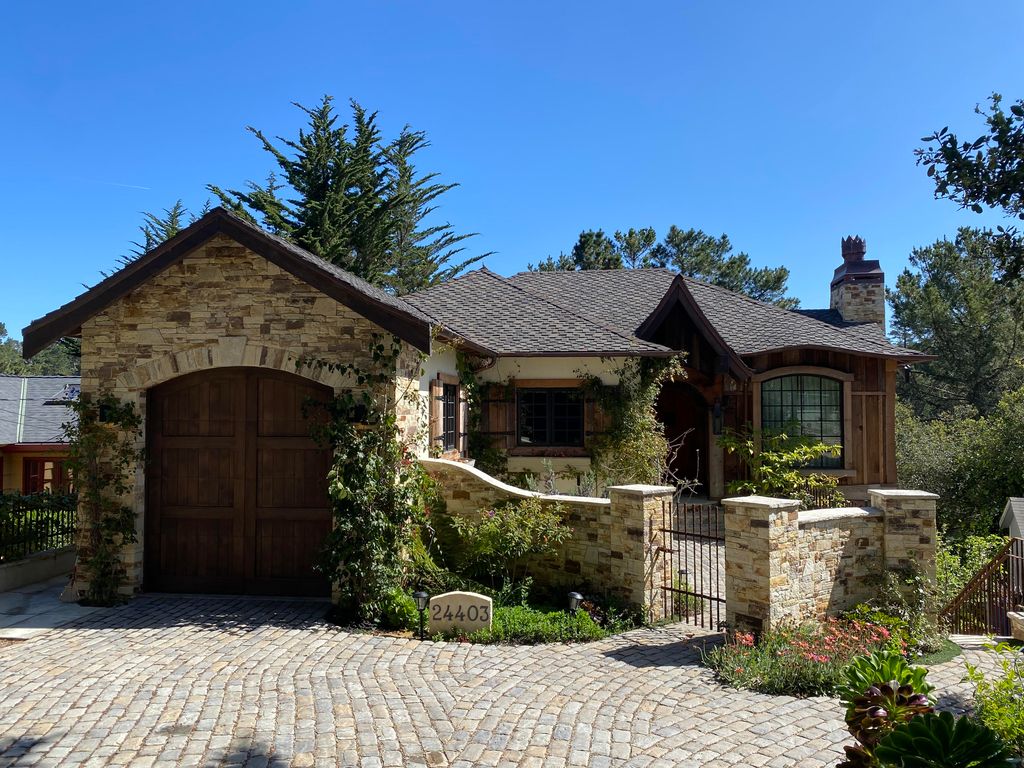
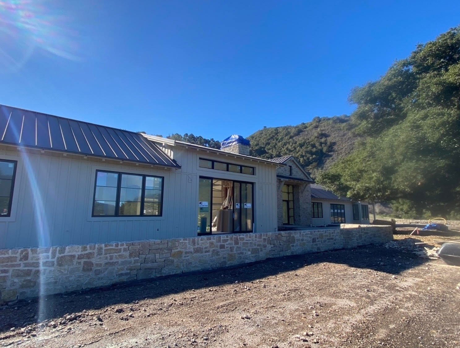
Harrod Built is a family general contractor (CSLB #986950) based in Paso Robles, and we work across Monterey County. We have not finished a Big Sur home to show yet; nearby, we built the Stone Cottage in Carmel-by-the-Sea pictured above and we are building a custom home in the Santa Lucia Preserve now. On a Big Sur project we can help with everything, one stop shop: sister studio Harrod Drafting & Design draws plans for County review (or we build to your architect’s set), we price the design while it is still a site study, plan the staking and access, and carry it through plan check and inspections on our process, and sister company Paso Robles Landscaping builds the landscaping and outdoor spaces with native screening and fire-safe planting. Planning a new home, additions or a rebuild? More on our Big Sur page and the Monterey County hub.
Own a parcel on the Big Sur coast, or thinking about buying one? We walk lots for free and look at the view from Highway 1, the slope, water, septic, fire access and the likely permit path before design gets expensive. Call 805-712-8993 or contact us.
Sources: Monterey County Big Sur Coast Land Use Plan (certified 1986, amended through January 2016) and the County’s Big Sur Coast Land Use Plan Update page; Big Sur Coastal Implementation Plan (Part 3, Chapter 20.145); Monterey County Code Title 20, Chapters 20.17 (Watershed and Scenic Conservation), 20.64 (guesthouses, transfer of development credits, slopes over 30 percent), 20.70 (coastal development permits and exemptions) and 20.86 (appeals); a County Planning Commission staff report for a Big Sur Coast Land Use Plan area rebuild; California Coastal Commission draft findings of the Monterey County LCP periodic review, Chapter 7 (Scenic Resources); Monterey County Environmental Health Bureau septic (OWTS/LAMP) page; Monterey County Housing & Community Development online permit page; Board of Forestry and Fire Protection State Minimum Fire Safe Regulations; Public Resources Code sections 4290 and 4291; Caltrans encroachment permit and District 5 Big Sur Highway 1 pages. The land use plan is being updated, and rules, fees and procedures change. This guide is general information, not legal advice. We confirm the current rules for each parcel with the County and the agencies.
Before you buy or design
A short Big Sur permit checklist
- Can any part of the likely building site, driveway or water tank be seen from Highway 1, a turnout, a beach or a named viewpoint?
- What is the zoning, and is the parcel seaward of Highway 1, near a bluff, a stream or a known archaeological site?
- Does any likely building area or road cross slopes of 30 percent or more?
- Is there a proven water source on the parcel, and has it been tested in the dry season?
- Do the soils and groundwater support a septic system with an expansion area?
- Is the parcel in a mapped fire hazard severity zone, and can the driveway meet the fire access rules?
- Does the driveway connect to Highway 1, and will it need a Caltrans encroachment permit?
- If a house stood here before, what are its documented floor area, height and location?
We answer these on a free walk. Nearby, we also build in Carmel Highlands, Carmel-by-the-Sea and Carmel Valley. For how other Monterey County communities review homes, see our Pebble Beach building permits guide, our Santa Lucia Preserve guide and our Carmel design review guide.

What is the Big Sur critical viewshed?
It is everything within sight of Highway 1 and major public viewing areas on the Big Sur coast, including turnouts, beaches and named viewpoints such as Bixby Creek Turnout and Pfeiffer Beach. Under the Big Sur Coast Land Use Plan, new public or private development visible from those places is generally prohibited, with a few narrow exceptions.
How does Monterey County decide whether a Big Sur house is visible?
Each application gets an on-site investigation. The house is shown with poles at its real height and rooflines, the road with stakes and flags, and the staking stays up through review and is photographed with the project superimposed. If any part can be seen from Highway 1 or a major public viewpoint, in any season, it is considered visible.
Do I need a coastal development permit to build in Big Sur?
Almost always for a new home or a significant addition. Development in the critical viewshed, on slopes of 30 percent or more, near sensitive habitat, near a bluff or with positive archaeological reports needs a coastal development permit with a public hearing, and many approvals can be appealed to the Coastal Commission.
Can I rebuild a Big Sur home lost to fire?
Usually, yes. The plan allows a structure lost to fire or natural disaster to be replaced in its original location if it does not become more visible, and the County code exempts a replacement from the coastal permit if it is the same use, in the same place and no more than 10 percent larger in floor area, height or bulk. A building permit and current fire codes still apply.
What water and septic do I need to build in Big Sur?
Most parcels need their own water and septic. The plan requires proof by seasonal testing of an adequate, good-quality supply, and septic systems follow the County Environmental Health Bureau’s program, with a feasibility report, a deep groundwater boring, percolation tests and room for an expansion area.
Planning guides
Budget and planning guides
What a custom home costs on the Central Coast
Rough per-square-foot ranges for SLO, Monterey and Santa Barbara counties, and what moves a home between them.
Cost to build a custom home in SLO County
What drives the budget on a Central Coast custom home, and how to get a real number.
ADU cost on the Central Coast
Detached, attached or conversion: what moves the price of an ADU or guest house.
Home remodel cost in Paso Robles & SLO County
Kitchens, baths, whole-home remodels and additions: the cost drivers we see.
Building on a hillside lot
Soils, foundations, retaining walls, drainage and access: what a sloped lot adds before the house begins.
How long it takes to build a custom home
The phases from lot to move-in, what sets the pace, and how long our own recent homes took to build.
Building with a well and septic in North County
Wells, septic under the County LAMP, Paso basin and will-serve letters: what a rural North County lot needs before the house.
Building in a fire hazard severity zone
What Chapter 7A (and the California Wildland-Urban Interface Code) change on the roof, vents, walls, windows, decks and landscape.
Build or buy a custom home on the Central Coast
Honest comparison: custom new build vs buying an existing home in SLO, Monterey and Santa Barbara counties.
SLO County building permits: city vs county
Seven cities vs unincorporated PermitSLO, planning vs building, coastal permits and fire-zone steps.
Coastal development permits in SLO County
Cambria, Cayucos, Morro Bay, Pismo Beach and Avila Beach: exempt vs CDP vs Minor Use Permit, and Coastal Commission appeals.
Building in the Santa Lucia Preserve
Design Review Board stages, CSD water and will-serve, lot-specific fuel management and Monterey County permits.
Pebble Beach building permits
Del Monte Forest coastal permits and design approval, Pebble Beach Company ARB, protected trees, Cal Am water and fire rules.
Carmel design review: Track 1 vs Track 2
Carmel-by-the-Sea design studies: staff-level Track 1 vs Planning Commission Track 2, site assessment, story poles, trees and volume.
Montecito Board of Architectural Review (MBAR)
What MBAR reviews, conceptual vs preliminary vs final review, what to submit, floor area guidelines, fire and water steps in Montecito.
Building in Hope Ranch: architectural review and County permits
The Association’s ABR stages, floor area, height and view rules, County design review and coastal permits, water, septic and fire access.
Start your project
Building in Big Sur? Tell us about your parcel.
A few details help us call you back with useful answers about budget, schedule and permits.
805.712.8993michael@harrodbuilt.com
1345 Riverside Ave, Paso Robles, CA 93446
CSLB License #986950